So you might be wondering, what is GIS?
GIS stands for Geographic Information Systems
and
it is a tool that can aid individuals with inventory management,
data analysis, and data acquisition.
If you have some sort of geographic component to your daily work flow then it can be incorporated into a GIS!
If you think your department could be utilizing GIS, please contact the GIS department to further consider the possibility!
There are many available options for getting your information out to the public and increasing transparency.
The City of Clovis has partnered with ESRI, a leading GIS software company. We have user licenses for their Standard ArcGIS Desktop Software, their ArcServer and their ArcOnline Cloud Services. If you would like to see real examples of what we can offer with the help of ESRI Click below.
Collection
We can help your department collect data using Trimble GPS units as well as any IOS or Android device.
Data Storage
The data collected is then directly stored, edited and maintained on our ArcServer.
Map Production
With the data in the right environment we can publish maps and applications that you can use, edit and distribute as you see fit.
Some examples of how the GIS Depatment contributes to the City of Clovis

Fire Zone Look Up
The City GIS maintains and updates the Look-Up used by dispatch and the Fire Department
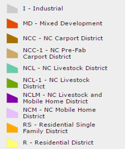
Planning and Zoning
The City GIS maintains and updates the Planning and Zoning data and provides public access to this information
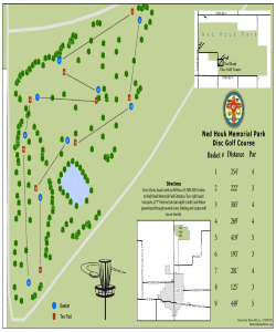
PDF Maps
The City GIS maintains, updates and provides public access to PDF copies of City related information
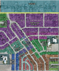
Subdivision Plats
The City GIS maintains and updates and provides public access to the Subdivision Plats recorded with Curry County